Partridge Island / East Bay (Parrsboro, Nova Scotia)
This afternoon I was able to attend another curatorial walk organized by the Fundy Geological Museum (FGM)about the geological features of Partridge Island, which is about a 15 minutes drive from Parrsboro. We left the FGM at about 1pm and arrived at the beach not long after. The tides were just starting to get low so Ken Adams (the interpretor and FGM's curator) took the time to explain the various geological puzzle pieces that make up this area. With our group was a woman that took video and audio of this tour to include in a bid to have the Bay of Fundy recognized as one of the world's new wonders of the world (currently the only Canadian site in the contest, #14 if I recall).
Here's a short description of the curatorial tour from the FGM website:
The rocks of East Bay-Partridge Island present a cross section through Parrsboro's geologic past. They tell of the warm tropical seas, shallow lakes and coal swamps that existed during the formation of Pangea, and the desert sands and volcanic flows deposited at the beginning of the age of dinosaurs.
- FGM Curatorial Walks

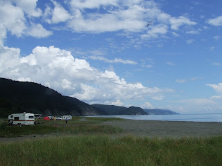
Partridge Island located south of Parrsboro, Nova Scotia

As I mentioned before, its about a 15 minutes drive from Parrsboro to Partridge Island's beach access. Down Whitehall Road you'll see the Ottawa House. There's a small dirt road called Partridge Island Road. Its a little tricky when you end up driving on the land that attaches the island to the mainland. Most of the time, you could call Partridge Island a 'presqu’île', or peninsula, which is a piece of land bordered by water on 3 sides, but with one remaining side connected to the mainland. I say this as even at high tide, the island is still showing attached to the mainland. Its only at high tide with its peak reached at the highest point of a lunar cycle that the island becomes a true island.

Cape Sharp (middle) and Cape Split (left, in the distance)

Partridge Island at high tide
This place is just fantastic. It was cooler by the beach compared to being in town. We could hear the calls of the loon, and other local birds cowering, looking for the whereabouts of the bald eagles nesting in the cliffs.

Close up of Cape Split

Ken (left), Matt (middle) and Scott (right)

Partridge Island
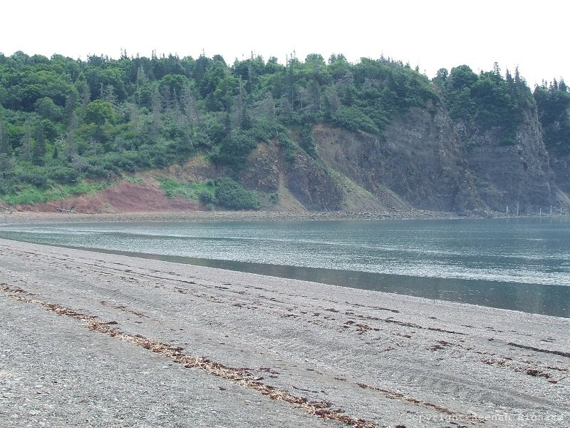
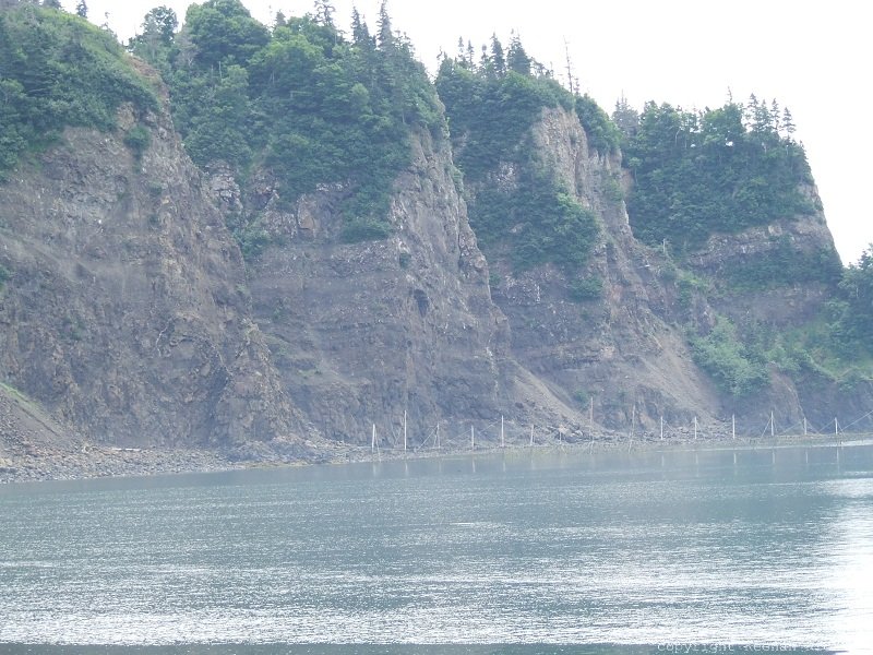
Looking at the island you can make out two types of formations. You have your reddish Triassic age sedimentary rock that's slightly tilted, and the darker volcanic basalt (same as what you'd see at Five Island Park) which overlaps the Triassic rock. The volcanic rock shows columnar features as well as layering of multiple lava flows on top of each other. We didn't go to the island but I will at another time to look around for fossils and minerals.
Lava flows

Bryzoa

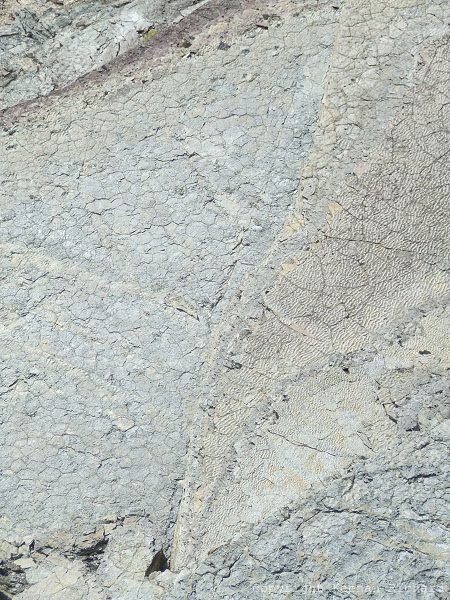
The lines, or striation, on this outcrop were created when ancient glaciers were moving, scaring the rock and leaving these marks. You can tell the direction the glaciers were moving (growing or retreating). With striation and glacial till, this provides some evidence that glaciers made their way further down the northern hemisphere (possibly almost a few longitudinal degrees of the equator during the Precambrian).

Close up of perpendicular striation

Partridge Island (left) and Cape Blomidon (right)

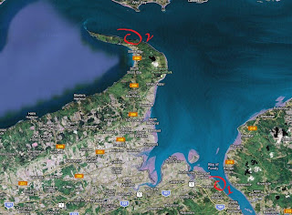
View of Partridge Island from East Bay

These layers, or strata, of sandstone contain quite an amount of fossils, mostly clams. These cliffs show layers over layers of sedimentary sands and mud featuring mud cracks and ripples. As you'll see further in this article, we'll encounter some animal footprints (probably from early amphibian animals as these rocks date from anywhere between 320 to 280 millions years ago).

Some rock outcrops we encountered along our walk showed the forces at work in the region as various faults show up, demonstrating how the continents were moving.

Clams in mud stone and shale
These sandstone cliffs show remarkable details. The right section of the picture above show ripples close together, and the left section show what looks like dried up mud. For me this looks like what could have been a body that had dried up either in a warm and dry climate or a body of water where its water level was getting low. You will sometime find trace fossils on these features, as we did that day.


Ken inspecting some trace fossils

Fist sized animal foot prints (middle in an 'S' shape)

We almost ran by these as we didn't notice them at first. Somebody spotted the tiny holes and then when our eyes adjusted, we could make out the fine toe prints of an animal that left its mark, strutting its stuff in the mud (line running in middle, showing as black dots).

Close up of trace fossils showing as black dots,
and a fist size impression in the mud (lower right)

Better close up of individual track(s)

Pair of foot prints in mudstone

Ken is pointing to a set of fossils that are going from bottom right close to where he is pointing his stick to the upper left. It was extremely hard to make them out at this angle, and the camera didn't help with picking up the details. I will have to probably invest in a camera that has a good zoom and deep macro depth.

Another angle (again hard to spot)

Foot print?

Another set of foot prints located at top left

Multiple set of footprints

More footprints (can you spot them?)

Ken had found these bizarre indentations beside what to be an animal dragging its body or part of its body. What was intriguing was that these indentations were on both sides of the drag mark and in equal distance on each side (top of Ken's head, on both sides of drag mark). Below Ken's hand is a fist sized foot print probably made by the same animal.

Another set of indentations close to the edge

One theory is that an animal was moving in a shallow body of water, dragging its body on the sand, possibly paddling with its front legs and digging its hind legs in the sandy floor to move forward. I imagine an animal that could have longer rear legs, using them to propel itself forward casually in the water. It doesn't answer why there is another set of indentations by itself but the sandstone slab is cut off, creating more questions than answers.

These rock formations show signs of extreme force, showing beautiful folding of strata that show like an accordion. Multiple 'S' patterns showing the direction of the fold.

Limestone containing shells

The crows and seagulls were getting agitated and pretty vocal at one point and somebody pointed out to a tall tree on top of the cliffs. Perched on that tree was this handsome bald eagle looking around. I had seen one earlier in a park about 10 minutes drive out of Parrsboro going towards Moncton, but I didn't have the chance to take a picture of it. There are quite a few type of eagles in the area from what I'm told.

Eagle taking off
Usually when I come to Parrsboro and find trace fossils, they're usually of the Triassic age from the early dinosaurs and reptiles like ancient crocodiles. What is nice about these sandstone cliffs is that they are from the Pennsylvanian (lower) Carboniferous Period, at about 320 to 280 million years (probably closer to 300 to 280 million years). The sheer number of them is intriguing and exciting. I've seen these before at the Brule museum in Tetamagouche, Nova Scotia, at the Cremerie. Next time I come here I'll have to venture to Partridge Island and see if I can find anything.
Till next time!
Disclaimer: In Nova Scotia under the 'Special Places Protection Act', fossils cannot be dug up or disturbed without a permit. The province has a mandate to protect palaeontological sites and it is your civic duty to report any finds to the local museum, or the Department of Communities, Culture and Heritage (https://cch.novascotia.ca/exploring-our-past/special-places). This encourages the contribution these finds could make to science not just in the provice, but on the global stage. You must also seek permission if you are to enter private land.