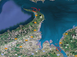
Rock Hunting in Rockport.. Part Deux
Two weeks before this last trek in Rockport, east of Dorchester NB, I found some good indicators of what could have been a very large body of water. The fossils that I was able to find were showing me a picture of trees all bunched up and stacked on top of each other, similar to what you would find in log jams in a body of water.
I also wanted to find out how the cliffs were structured in the Bay of Fundy outside the protection of Slacks Cove. I was curious if the cliffs exposed to the active bay on the New Brunswick side were similar to the sister cliffs at Joggins in Nova Scotia. The silt and seaweed on the rocks were making my getting on the other side tricky.


The top of the sandstone layers shows ripples, a good sign this was probably sand from a shallow body of water or something similar.
These cliffs were very hard to access as the seaweed and silt made the trek very treacherous. For the amount of time it takes to get there I would need to find alternative ways to reach them via other roads or trails. I'll need to pan out the topographical map of the area and scout the numerous trails, most of them used by local loggers. The area looks promising and I can get a clearer picture of how this area would have looked like over 300 million years ago.


